


FJD Trion Model
This removes tedious manual processes, enabling professionals to focus on their expertise and make well-informed decisions.
$3,450.00 excl GST
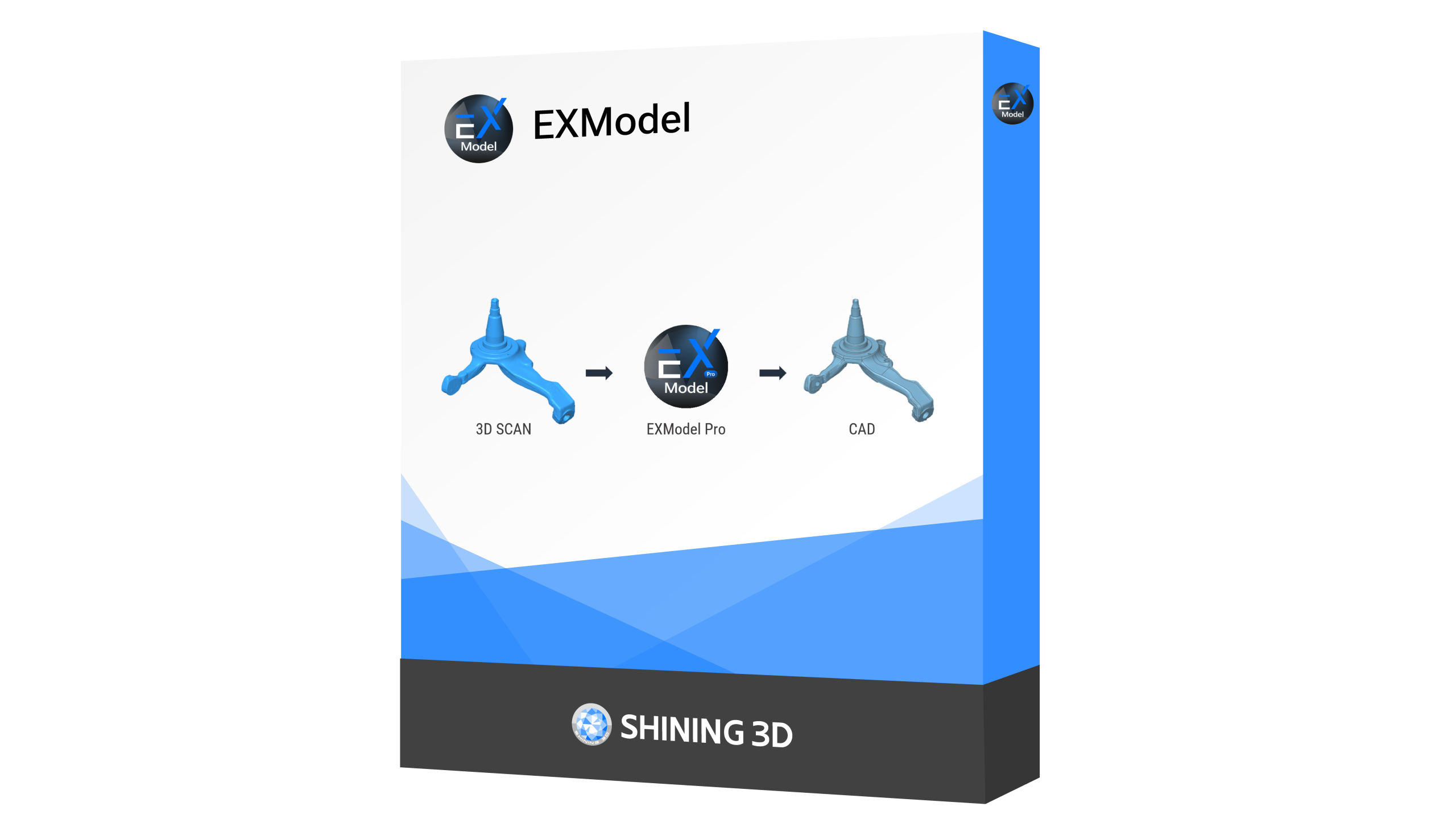
FJD Trion Model Point Cloud Processing Software
Easily manipulate and analyze point cloud data with the FJD Trion Model, designed with a user-friendly interface and advanced algorithms. This all-in-one software integrates modules for forestry, drawing, and robot mapping, simplifying data import and analysis. Choose FJD Trion Model for seamless, efficient, and versatile point cloud processing.
Essential Processing Funtions
Profile Analysis
Generate and analyze multiple cross-sections to assess point cloud data quality.
Generate and analyze multiple cross-sections to assess point cloud data quality.
Volume Calculation
Accurately measure stockpile and enclosed volumes.
Accurately measure stockpile and enclosed volumes.
Auto Classification
Automatically categorize point cloud data for buildings, trees, and geological features—ideal for urban planning, forestry, and mineral exploration.
Automatically categorize point cloud data for buildings, trees, and geological features—ideal for urban planning, forestry, and mineral exploration.

One-Click Tilt Correction
Easily fix point cloud tilt with just one click.
Easily fix point cloud tilt with just one click.
Clearer Point Cloud Rendering Effect
Deliver superior visual clarity on point cloud thanks to the high-resolution performance and powerful processors, rendering images smoother than ever before on PC.
Files & Registering
| Input Formats | Geo-Referencing | Output Formats | Automatic Target Detection | Stitching Multiple Scans |
|---|---|---|---|---|
| .las, .ply, .pts, .e57 | Yes | LAS Cloud (.las, .laz), ASCII cloud (.txt, .asc, .neu, .xyz, .pts, .csv), Model entities (.bin), E57 cloud (.e57), PLY mesh (.ply), DXF Geometry (.dxf), Point Cloud Library Cloud (.pcd), Point Cloud (.pn), Point+Value cloud (.pv) | Yes | Yes |
Related products
Price range: $148.50 through $212.55 excl GST
Select options This product has multiple variants. The options may be chosen on the product page$8,040.00 excl GST
$9,643.20 excl GST